City map of Givet
$ 42.77
Description
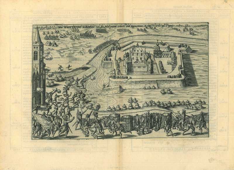
City map of Givet. Charlemont. A plan of the Fortress of Charlemont at Givet, in the Ardennes department. Copper Engraving, 1616. Source: L. Guicciardini. Omnium Belgii Sive Inferioris Germaniae Regionum Descriptio (...). Arnhem, J. Jansz., 1616. Reasonable condition. Paper a bit browned. A few small wormholes in the lower margin, not affecting the image. Verso: Latin text. Dimensions: 125 x 199 mm. Charlemont. A plan of the Fortress of Charlemont at Givet, in the Ardennes department. Copper Engraving, 1616. Source: L. Guicciardini. Omnium Belgii Sive Inferioris Germaniae Regionum Descriptio (...). Arnhem, J. Jansz., 1616. Reasonable condition. Paper a bit browned. A few small wormholes in the lower margin, not affecting the image. Verso: Latin text. Dimensions: 125 x 199 mm.
Related products
-
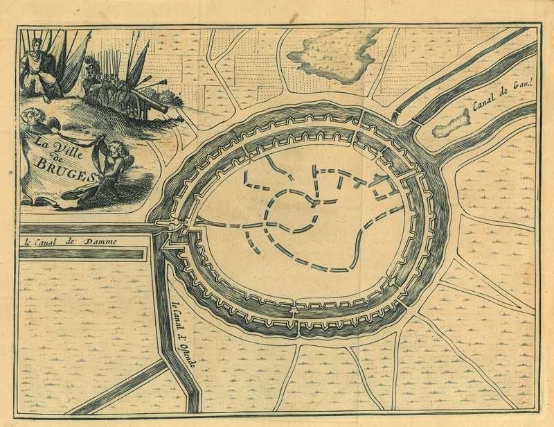
City map of Bruges
$ 39.21 -
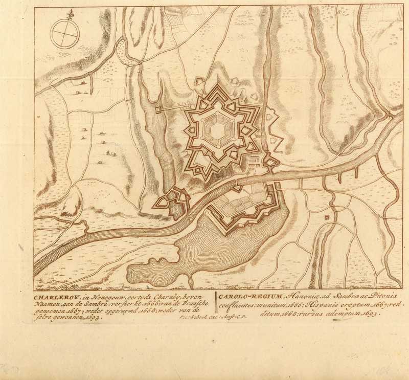
City map of Charleroi
$ 49.9 -
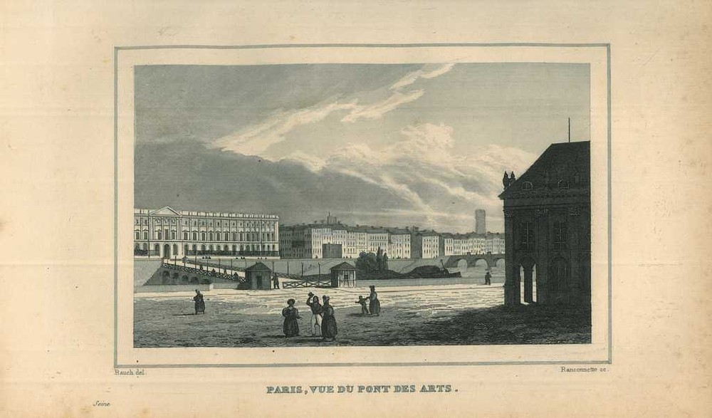
View of Paris
$ 24.95 -
Historical print of Westerlo
$ 92.67