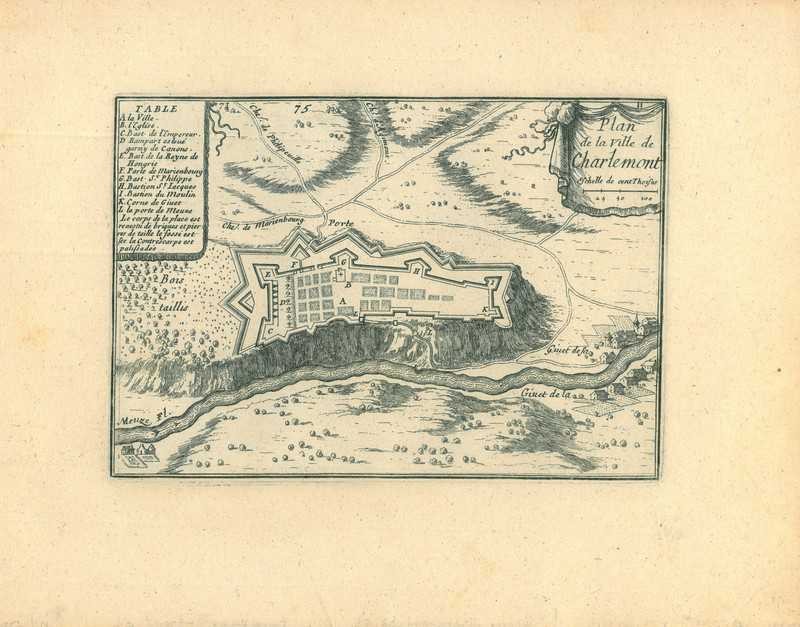
City map of Givet
$ 35.64
Description
City map of Givet. Plan de la Ville de Charlemont. A map of the Fortress of Charlemont at Givet, in the Ardennes department. Etching and Engraving, 1668. Source: S. Pontault de Beaulieu. Les plans et profils des principales Villes et lieux considerables (...). Paris, S. de Beaulieu, 1668. Reasonable condition. Paper slightly soiled and slightly browned. Some brown stains in the lower margin not affecting the image. Some minor creasing. Verso: blank. Dimensions: 107 x 154 mm. Plan de la Ville de Charlemont. A map of the Fortress of Charlemont at Givet, in the Ardennes department. Etching and Engraving, 1668. Source: S. Pontault de Beaulieu. Les plans et profils des principales Villes et lieux considerables (...). Paris, S. de Beaulieu, 1668. Reasonable condition. Paper slightly soiled and slightly browned. Some brown stains in the lower margin not affecting the image. Some minor creasing. Verso: blank. Dimensions: 107 x 154 mm.
Related products
-
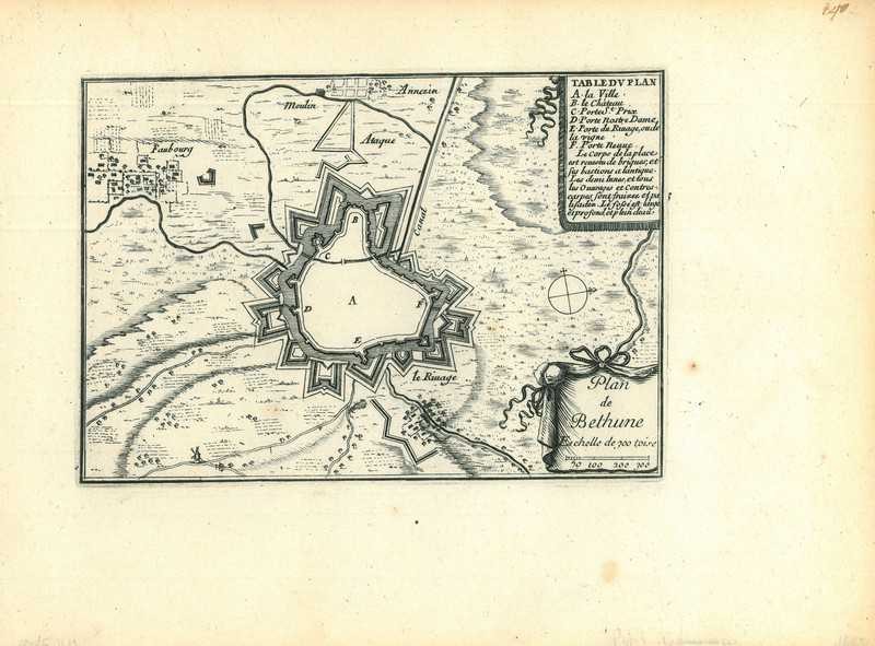
City map of Bethune
$ 35.64 -
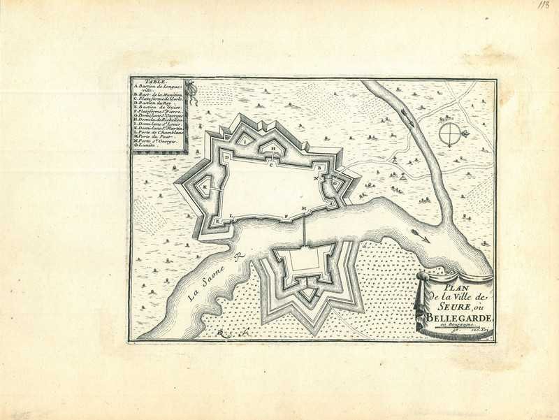
City map of Seurre
$ 42.77 -
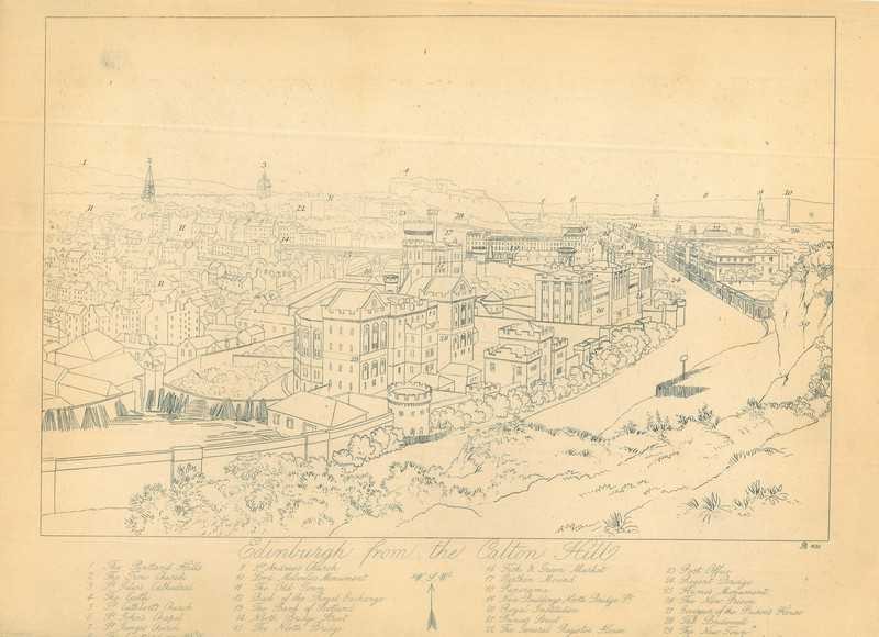
View of Edinburgh
$ 35.64 -
City map of Givet
$ 39.21