Denmark 1720 Henry Abraham Chatelain Large Unusual Antique Copper Engraved MapANTIQUE COPPER ENGRAVED MAP OF DENMARK 1720 CHATELAIN
$ 10.56
Description
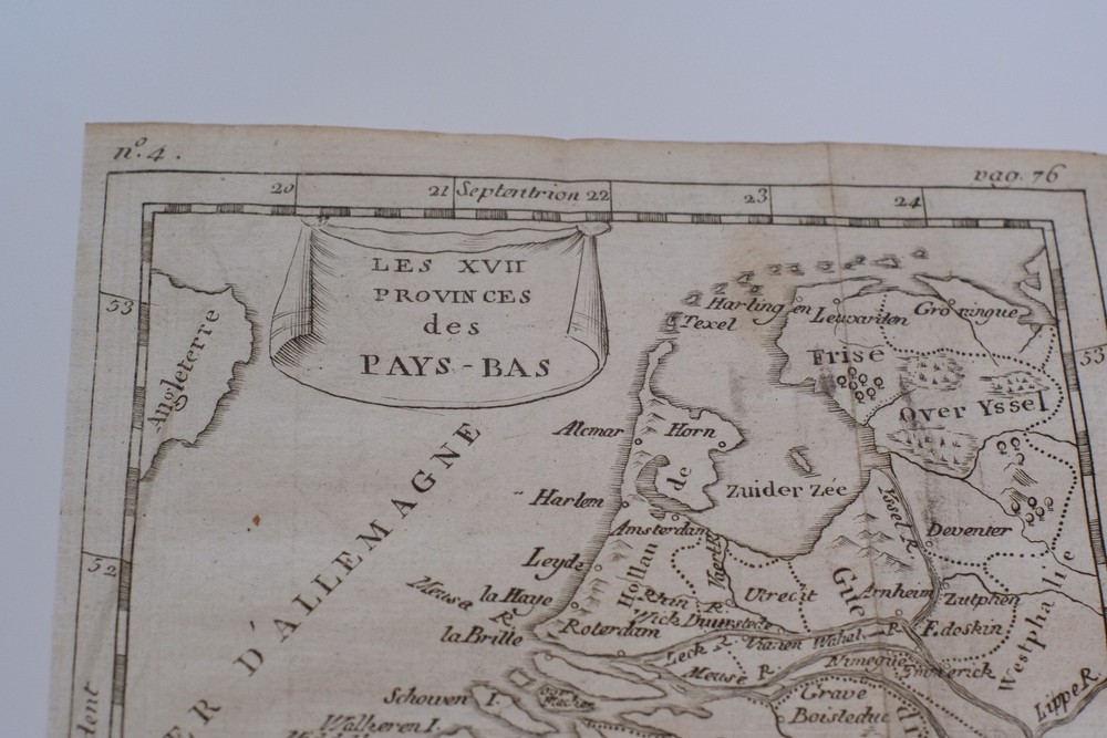
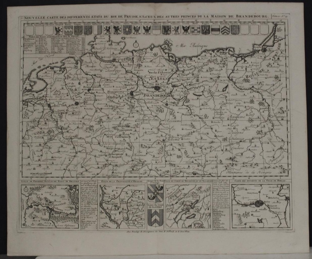
DENMARK 1720 HENRY ABRAHAM CHATELAIN LARGE UNUSUAL ANTIQUE COPPER ENGRAVED MAP. Includes also southern part of Seden and north-western part of Germany. Relief shown pictorially. Shows geographical features of the area, including waterways, mountains and forests. Includes tables on either side of the map identifying the principal towns and different states. DENMARK 1720 HENRY ABRAHAM CHATELAIN LARGE UNUSUAL ANTIQUE COPPER ENGRAVED MAP DENMARK 1720 HENRY ABRAHAM CHATELAIN LARGE UNUSUAL ANTIQUE COPPER ENGRAVED MAP Description Nouvelle Carte Geographique du Royaume de Dannemarck avec une Table des Villes les Plus Remarquable. Description: Striking and highly detailed fine unusual 1720 Henri Abraham Chatelain's copper engraving map depicting all of Denmark. Includes also southern part of Seden and north-western part of Germany. Relief shown pictorially. Shows geographical features of the area, including waterways, mountains and forests. Includes tables on either side of the map identifying the principal towns and different states. Composition and Medium: The map is an engraved work, showcasing the geographical features of Denmark, including the Isle de Fyonie and Isle de Selande. Relief is depicted pictorially, providing a visual sense of the terrain, such as mountains and forests. It includes detailed outlines of waterways, a crucial element for understanding the geographical and strategic considerations of the time. Style and Subject Matter: The style of the map is typical of early 18th-century cartography, with a focus on clarity and detail. It combines both geographical and political information, illustrating the boundaries and principal towns of Denmark. The map is flanked by tables that list notable towns and states, offering a comprehensive overview of the region. Cultural and Historical Context: This map was created during a period when cartography was experiencing significant advancements, influenced by the Enlightenment's emphasis on knowledge and exploration. It reflects the European interest in geography and the desire to catalog and understand the world in detail. The map is part of an atlas known for its encyclopedic nature, combining maps with historical, political, and genealogical information. Significant Features: - Title and Inscriptions: The title is prominently displayed at the top, denoting the focus on Denmark and its significant towns. - Landmarks: Various geographical features such as mountains, forests, and waterways are illustrated, providing insight into the landscape of early 18th-century Denmark. - Tables: On either side of the map, tables list principal towns and states, which were significant for administrative and navigational purposes. Source: Atlas Historique, Ou Nouvelle Introduction A l'Histoire, aÌ la Chronologie & aÌ la Geìographie Ancienne & Moderne : Repreìsenteìe dans de Nouvelles Cartes, OuÌ l'on remarque l'Etablissement des Etats & Empires du Monde, leur dureìe, leur chute, & leurs differens Gouvernemens … Par Mr. C.***. Avec des Dissertations sur l'Histoire de chaque Etat. Par Mr. Gueudeville. Amsterdam, chez l’Honore & Chatelain. Tome 1-7. Date: 1720 ( undated ) Dimensions: Paper size approx.: cm 66,6 x 54,4 Conditions: Very strong and dark impression on good paper. Paper with chains. Map un colored. Wide margins. Small foxing and browning. Map folded. Conditions are as you can see in the images. Mapmaker: Henri Abraham Chatelain (1684 - 1743) was a Huguenot pastor of Parisian origins. He lived consecutively in Paris, St. Martins, London (c. 1710), The Hague (c. 1721) and Amsterdam (c. 1728). He is best known as a Dutch cartographer and more specifically for his cartographic contribution in the seminal seven volume Atlas Historique, published in Amsterdam between 1705 and 1720. Innovative for its time, the Atlas Historique combined fine engraving and artwork with scholarly studies of geography, history, ethnology, heraldry, and cosmography. Some scholarship suggests that the Atlas Historique was not exclusively compiled by Henri Chatelain, as is commonly believed, but rather was a family enterprise involving Henri, his father Zacharie and his brother, also Zacharie. All of the maps we sell are ORIGINALS. We guarantee all of our maps to be authentic. We do our best to describe the condition of our maps as accurately as possible. Due to the age and type of paper, some imperfections are to be expected. Please examine the images provided carefully, and if you have any questions please ask and we will be happy to help. A Certification of Authenticity ( COA ) can be issued on request I will send you all your item by FedEx/DHL with covering Insurance If you buy more than one item you have to pay just one only shipping cost Any map purchased from us may be returend for any reason for a full refund. Shipping: Customs may be charged on international shipments. All customs charges are the responsiblity of the buyer and are not included in the selling price. All goods destined for the United States are exempt from any taxation. About: Old Times Rare Antiquarian Books & Maps Sellers Our Firm was founded in 1983 and we are specialized on antiquarian works on paper concerning Antique Rare Maps, Atlases and Travel Books of all the World. Our Firm adheres to the Codes of Ethics outlined by the Italian Antiquarian Booksellers Association ( ALAI ) and International League of Antiquarian Booksellers ( ILAB ). All items sold by OLD TIMES are genuine and a Certificate of Authenticity (COA) will be happily supplied on request. Many Thanks View My Feedback View My Other Items For Sale View My About Me page Visit My eBay Store Add me to your Favorite Sellers Click images to enlarge Pictures sell! Auctiva offers Free Image Hosting and Editing. 300+ Listing Templates! Auctiva gets you noticed! The complete eBay Selling Solution. Track Page Views With Auctiva's Counter