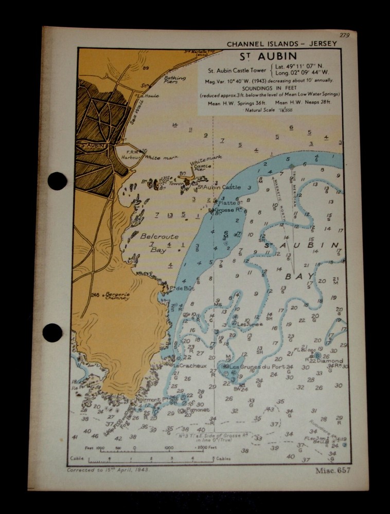
GOREY, JERSEY, Channel Islands - Rare Vintage naval WW2 map 1943
$ 2.56
Description
Vintage Naval WW2 Map of GOREY, JERSEY, Channel Islands - 1943 Published by the Hydrographic Department of the Admiralty, for a Naval Handbook. Originally RESTRICTED but now declassified. In good condition showing amazing detail. Used for Coastal defence. Delightful example of fine cartography. Corrected to 15th April 1943. Natural Scale 1: 22,500. Soundings in Feet. Printed on fine card. Overall size: 6.5(w) x 9.5(h) ins. Suitable for framing. This is a genuine map and not a copy, facsimile or computer generated image. Please see my other auctions/sales for similar. PAYPAL only. UK P&P £1.75. Combined postage available.