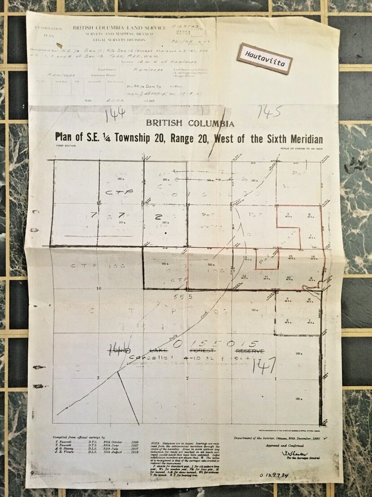
Kamloops BC Survey Map Proposed RoadFill Well Site Oil 1953 Canadian Bechtel
$ 14.99
Description
Kamloops BC Survey Map Proposed RoadFill Well Site 1953 by Canadian Bechtel Ltd Very nice Survey plan map of Kamloops BC area. Marked ,Proposed Road Fill at Kamloops Well Site.Aug 25,1953. Backside date stamped,Sept 1,1953.Engineering Dept Vancouver BC. Measures 46 x 22 inches. Condition: Very nice overall condition.No tears,rips,stains,soiling or damage.Folded. Very nice survey map with drawings. Canadian Bechtel Ltd is part of the companies that built the Trans Mountain Pipeline from Alberta to Vancouver BC in 1951-53. Shipping for Canada$10.00 and USA is $16.00can$ and Outside N.A. must be requoted. Please verify International shipping costs before bidding. Items that exceed $40.00 will have to be recalculated for Domestic International Shipping. Please Read the Full Description before bidding and purchasing. And Please wait for Invoice to be sent so i can forward the correct shipping,for domestic,and International Rates. Combined shipping for multiple purchases,Please wait for invoice. Item shown is item to be delivered.All sales are final. When item(s) received and your happy and leave feedback, seller feedback will be posted. Item shipped insured ebay. Great item for the collector . Thanks for looking .Bid with confidence. 23Years of Longtime service on Ebay.