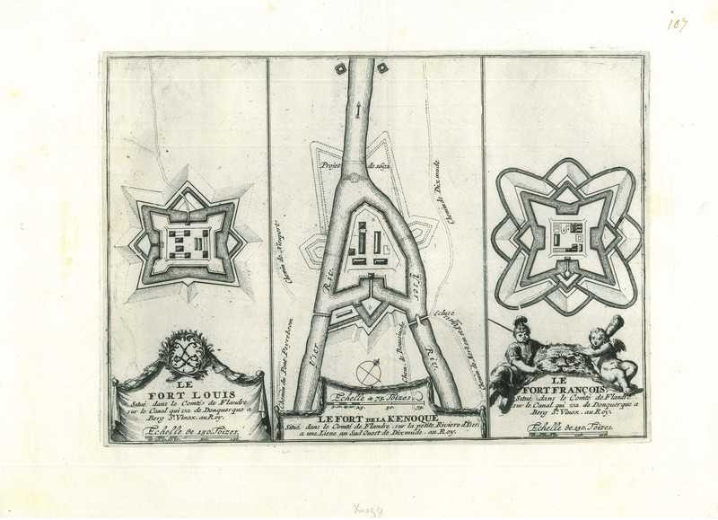
City map of Fort Knokke
$ 32.08
Description
City map of Fort Knokke. Le Fort De La Kenoque. Three fortification maps: (1) a map of Fort Knokke; (2) a map of Fort-Louis; (3) a map of Fort-Francois. Copper Engraving by Herman van Loon (fl. c. 1700), c. 1700. Source: N. de Fer. Les forces de l'Europe (...), c. 1700. Good condition. Paper slightly browned and slightly soiled. Verso: blank. Note: with two other maps: �Le Fort Louis" ''Le Fort Francois'' Dimensions: 195 x 273 mm. Le Fort De La Kenoque. Three fortification maps: (1) a map of Fort Knokke; (2) a map of Fort-Louis; (3) a map of Fort-Francois. Copper Engraving by Herman van Loon (fl. c. 1700), c. 1700. Source: N. de Fer. Les forces de l'Europe (...), c. 1700. Good condition. Paper slightly browned and slightly soiled. Verso: blank. Note: with two other maps: �Le Fort Louis" ''Le Fort Francois'' Dimensions: 195 x 273 mm.
Related products
-
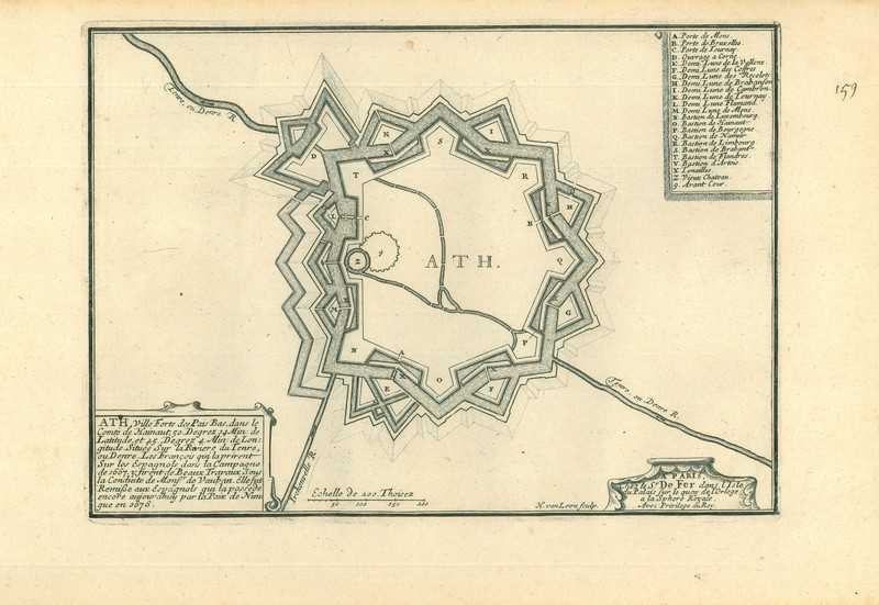
City map of Ath
$ 42.77 -
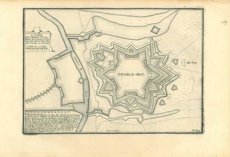
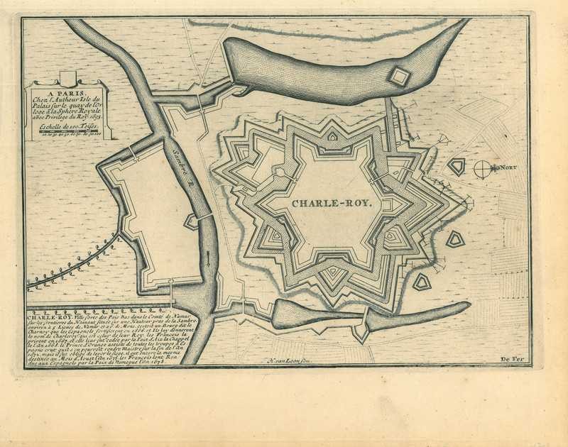
City map of Charleroi
$ 42.77 -
City map of Fort Knokke
$ 35.64 -
City map of Charleroi
$ 49.9