City map of Fort Knokke
$ 35.64
Description
City map of Fort Knokke. Le Fort De La Kenoque. Three fortification maps: (1) a map of Fort Knokke; (2) a map of Fort-Louis; (3) a map of Fort-Francois. Etching and Engraving, c. 1700. Source: N. de Fer. Les forces de l'Europe (...), c. 1700. Reasonable condition. Paper expertly cleaned and flattened. A small wormhole in the middle of the image. Verso: blank. Note: with two other maps: �Le Fort Louis" ''Le Fort Francois'' Dimensions: 194 x 269 mm. Le Fort De La Kenoque. Three fortification maps: (1) a map of Fort Knokke; (2) a map of Fort-Louis; (3) a map of Fort-Francois. Etching and Engraving, c. 1700. Source: N. de Fer. Les forces de l'Europe (...), c. 1700. Reasonable condition. Paper expertly cleaned and flattened. A small wormhole in the middle of the image. Verso: blank. Note: with two other maps: �Le Fort Louis" ''Le Fort Francois'' Dimensions: 194 x 269 mm.
Related products
-
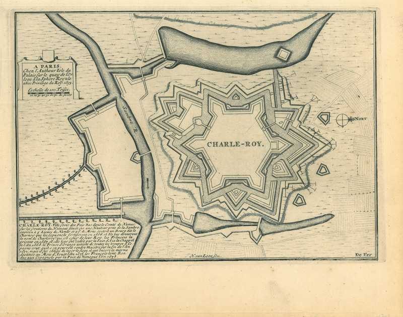
City map of Charleroi
$ 49.9 -
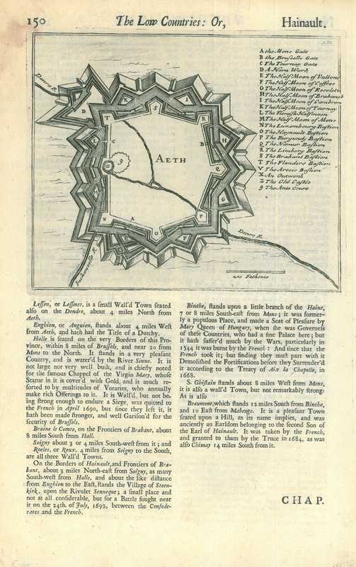
City map of Ath
$ 46.34 -
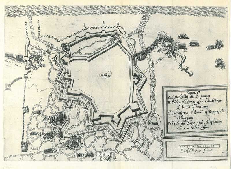
City map of Ostend
$ 46.34 -
City map of Ostend
$ 71.28