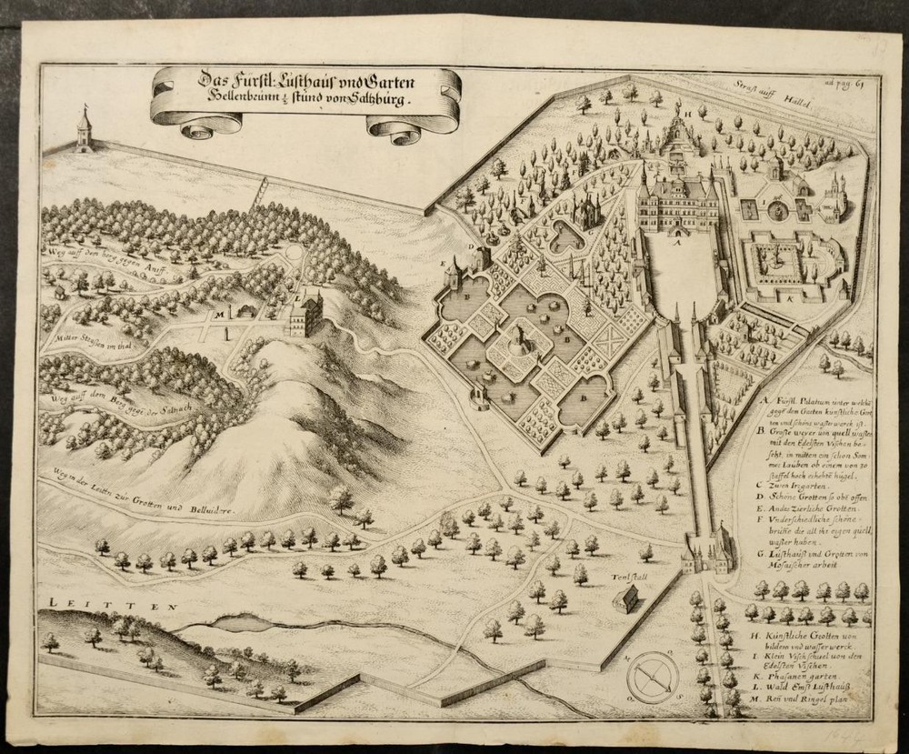
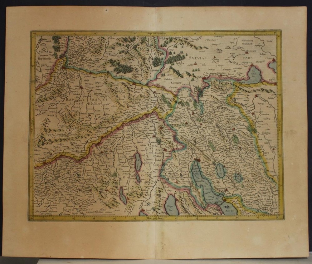
Prignitz Ruppin Germany 1640 Blaeu Unusual Antique Original Copper Engraved MapANTIQUE COPPER ENGRAVED MAP OF BRANDENBURG GERMANY
$ 10.83
Description
PRIGNITZ RUPPIN GERMANY 1640 BLAEU UNUSUAL ANTIQUE ORIGINAL COPPER ENGRAVED MAP. It details towns, rivers, forests, and other geographical features with precision. Olao Iohannis Gotho. The map is a hand-colored engraving, typical of Blaeu's work, which is celebrated for its clarity, detail, and vibrant colors. PRIGNITZ RUPPIN GERMANY 1640 BLAEU UNUSUAL ANTIQUE ORIGINAL COPPER ENGRAVED MAP PRIGNITZ RUPPIN GERMANY 1640 BLAEU UNUSUAL ANTIQUE ORIGINAL COPPER ENGRAVED MAP Description Marchionatus Brandenburgici partes duæ, Ruppin comitatus & Prignits Regioncula auct. Olao Iohannis Gotho. Description: Striking and highly detailed fine unusual 1640 approx. copper engraved map focusing on the Ruppin and Prignitz areas, parts of the Margraviate of Brandenburg, located in modern-day Germany. It details towns, rivers, forests, and other geographical features with precision. The map reflects the political and territorial divisions of the time, highlighting boundaries and settlements. Composition and Medium: The map is a hand-colored engraving, typical of Blaeu's work, which is celebrated for its clarity, detail, and vibrant colors. The map's composition features a decorative cartouche in the lower left corner, embellished with artistic figures and flourishes. The cartouche is a hallmark of Blaeu's style, enhancing both the aesthetic appeal and the informational content of the map. Style and Features: Blaeu's style is characterized by meticulous detail and artistic embellishments. The map includes a richly decorated figurate title cartouche. The top and bottom of the map include ornamental elements, with cherubs holding banners and two blank coats of arms, which add a sense of grandeur and importance to the depicted region. Cultural and Historical Context: Joan Blaeu was a prominent Dutch cartographer in the 17th century, a period known as the Dutch Golden Age of cartography. This era was marked by significant advancements in navigation, exploration, and map-making, driven by the economic and colonial expansion of the Dutch Republic. Blaeu's maps were highly sought after for their accuracy, beauty, and the prestige they conferred upon their owners. The "Atlas Maior" itself is considered one of the greatest achievements in the history of cartography, lauded for its comprehensive scope and the quality of its production. It was published in several languages, reflecting its wide appeal and the international influence of Dutch cartography. Notable Inscriptions and Landmarks: The map is replete with inscriptions, denoting towns, rivers, and regions, all rendered in Latin, the scholarly language of the time. The meticulous labeling provides insights into the historical geography of the Brandenburg region. Significant landmarks include the depicted forests and waterways, which were crucial for transportation and trade. In summary, this map by Joan Blaeu is a testament to the cartographic excellence of the 17th century, combining scientific accuracy with artistic elegance. It offers a detailed view of the Brandenburg region during a time of significant political and geographical developments, providing valuable insights into the history and culture of the period. Latin text on the verso. Source: Atlas Maior Sive Cosmographia Blaviana, Qua Solvm, Salvm, Coelvm, Accvratissime Describvntvr . Date: 1640 approx. ( undated ) Date: Paper size approx.: cm 60,9 x 48,7 Condition: Very strong and dark impression on good paper. Paper with chains and wiremarks. Map old original colored. Wide margins. Corners partially missing. Small foxing and browning. Small marginal tears. Map folded. Conditions are as you can see in the images. Mapmaker: The Blaeus: Willem Janszoon, Cornelis & Joan Willem Jansz. Blaeu and his son Joan Blaeu are the most widely known cartographic publishers of the seventeenth century. Willem Jansz. (also written Guilielmus Janssonius) = Willem Janszoon Blaeu, was born in Uitgeest (Netherlands), near Alkmaar in 1571. He studied mathematics under Tycho Brahe and learned the theory and practice of astronomical observations and the art of instrument- and globe making. In 1596 he came to Amsterdam where he settled down as a globe-, instrument- and map-maker. He published his first cartographic work (a globe) in 1599 and probably published his first printed map (a map of the Netherlands) in 1604. He specialized in maritime cartography and published the first edition of the pilot guide Het Licht der Zeevaert in 1608, and was appointed Hydrographer of the V.O.C. (United East India Company) in 1633. After thirty years of publishing books, wall maps, globes, charts and pilot guides, he brought out his first atlas, Atlas Appendix (1630). This was the beginning of the great tradition of atlas-making by the Blaeu's. In 1618 another mapmaker, bookseller and publisher, Johannes Janssonius established himself in Amsterdam next door to Blaeu's shop. It is no wonder that these two neighbours, who began accusing each other of copying and stealing their information, became fierce competitors who did not have a good word to say about each other. In about 1621 Willem Jansz. decided to put an end to the confusion between his name and his competitor's, and assumed his grandfather's sobriquet, 'blauwe Willem' ('blue Willem'), as the family name; thereafter he called himself Willem Jansz. Blaeu. Willem Janszoon Blaeu died in 1638, leaving his prospering business to his sons, Cornelis and Joan. Of Cornelis, we only know that his name occurs in the prefaces of books and atlases until c. 1645. Joan Blaeu, born in Amsterdam, 1596, became partner in his father’s book trade and printing business. In 1638 he was appointed his father’s successor in the Hydrographic Office of the V.O.C. His efforts culminated in the magnificent Atlas Major and the town-books of the Netherlands and of Italy – works unsurpassed in history and in modern times, which gave eternal fame to the name of the Blaeu's. On February 23, 1672, a fire ruined the business. One year later, Dr Joan Blaeu died. The fire of 1672 and the passing away of the director gave rise to a complete sale of the stock of the Blaeu House. Five public auctions dispersed the remaining books, atlases, copperplates, globes, etc., among many other map dealers and publishers in Amsterdam. The majority was acquired by a number of booksellers acting in partnership. In the succeeding years, the remaining printing department was left in the hands of the Blaeu family until 1695 when also the inventory of the printing house was sold at a public auction. That meant the end of the Blaeu's as a printing house of world renown. All of the maps we sell are ORIGINALS. We guarantee all of our maps to be authentic. We do our best to describe the condition of our maps as accurately as possible. Due to the age and type of paper, some imperfections are to be expected. Please examine the images provided carefully, and if you have any questions please ask and we will be happy to help. A Certification of Authenticity ( COA ) can be issued on request I will send you all your item by FedEx/DHL with covering Insurance If you buy more than one item you have to pay just one only shipping cost Any map purchased from us may be returend for any reason for a full refund. Shipping: Customs may be charged on international shipments. All customs charges are the responsiblity of the buyer and are not included in the selling price. All goods destined for the United States are exempt from any taxation. About: Old Times Rare Antiquarian Books & Maps Sellers Our Firm was founded in 1983 and we are specialized on antiquarian works on paper concerning Antique Rare Maps, Atlases and Travel Books of all the World. Our Firm adheres to the Codes of Ethics outlined by the Italian Antiquarian Booksellers Association ( ALAI ) and International League of Antiquarian Booksellers ( ILAB ). All items sold by OLD TIMES are genuine and a Certificate of Authenticity (COA) will be happily supplied on request. Many Thanks View My Feedback View My Other Items For Sale View My About Me page Visit My eBay Store Add me to your Favorite Sellers Click images to enlarge Get images that make Supersized seem small. Showcase your items with Auctiva's Listing Templates! THE simple solution for eBay sellers. Track Page Views With Auctiva's Counter